vēra · spectra true · observation
Actionable insight earned from precision capture and accurate interpretation of remote-sensing data.

A small specialist firm translating remote-sensing data into ground truth for utilities, energy, agriculture, and the operators that fly them.

vēra · spectra true · observation
Actionable insight earned from precision capture and accurate interpretation of remote-sensing data.
sensor decision capture · processing · deliverable
Whether the input is an EO raster capture for precision mapping, an electrical component inspection, or TDLAS gas detection our job is to clean it, interpret it, and hand back something your team can actually use.
small exacting one workshop · clear standards
By design, we are small — one workshop, one set of standards, and the patience to take work that doesn't fit a stock platform. We collaborate clearly, deliver reliably, and stand behind our data products.
 Fig. 01 · Photogrammetric Orthomosaic
Captures processed into seamless georeferenced mosaics, measurements, contours, and planimetrics. Calibrated for survey-grade tolerances when control points are collected; rapid turn-around for inspection-grade jobs.
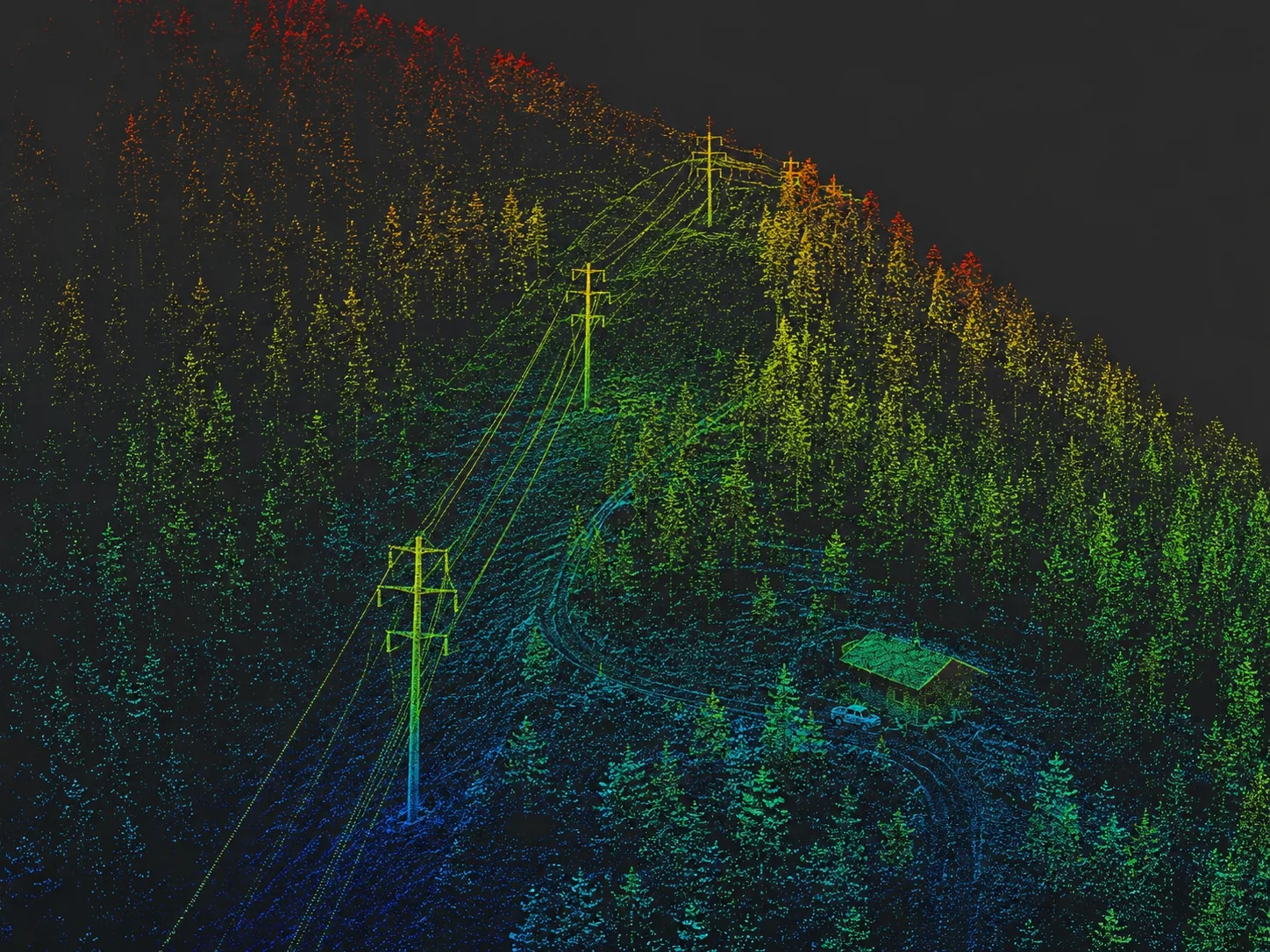 Fig. 02 · LiDAR Infrastructure Scan
Classification, ground extraction, infrastructure feature picking, and conversion to maps and models in whatever downstream format your team needs.
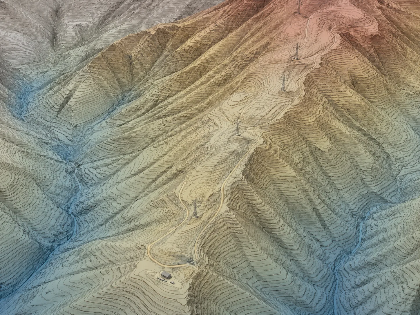 Fig. 03 · Contour Map
DEM, DTM, DSM, breaklines, contours, and derivative products built from your LiDAR or photogrammetry captures, or existing data sets. We can help you convert any georeferenced data into maps, vector paths, direct insights, or whatever data product you need.
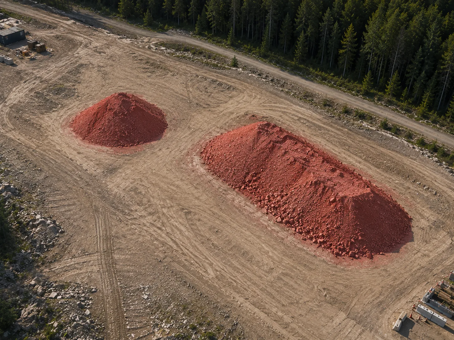 Fig. 04 · Cut/Fill, Stockpile Volume
Stockpile inventories, earthworks reconciliation, period-over-period change detection.
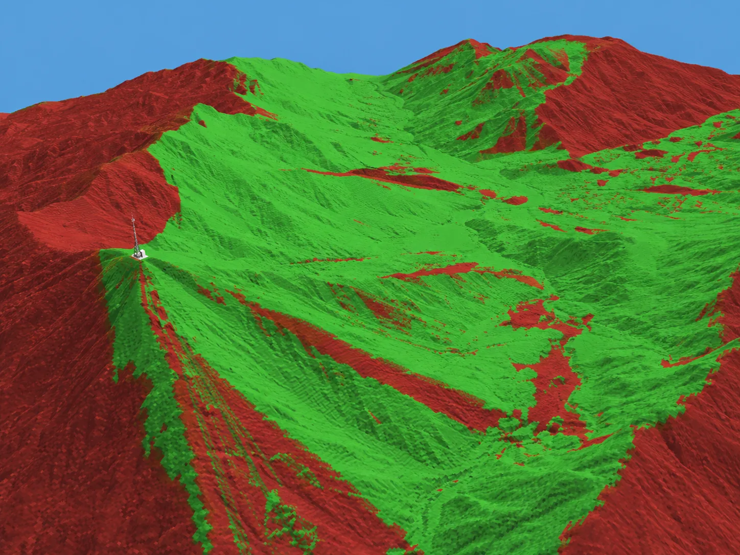 Fig. 05 · Cellular Viewshed
Visibility modeling for decision-making — communications towers, camera placement, observation posts, and approach corridors.
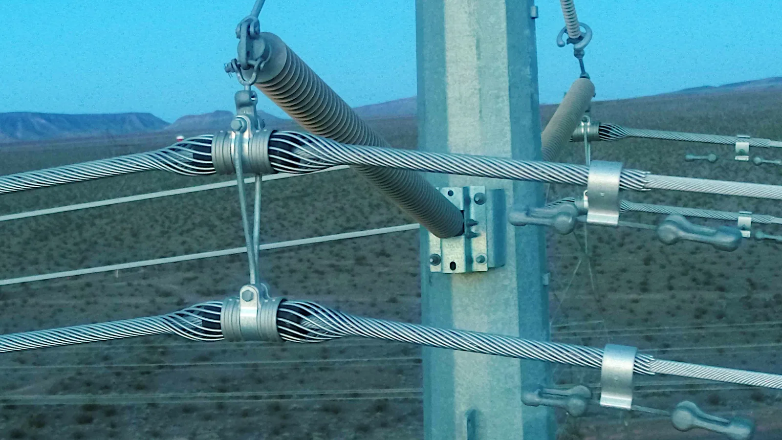 Fig. 06 · Transmission Asset Inspection
End-to-end UAV inspection of electrical infrastructure — flight planning, capture, condition assessment to your organization's standards, processing, and delivery via secure download, hosted portal, or straight into your EAM.
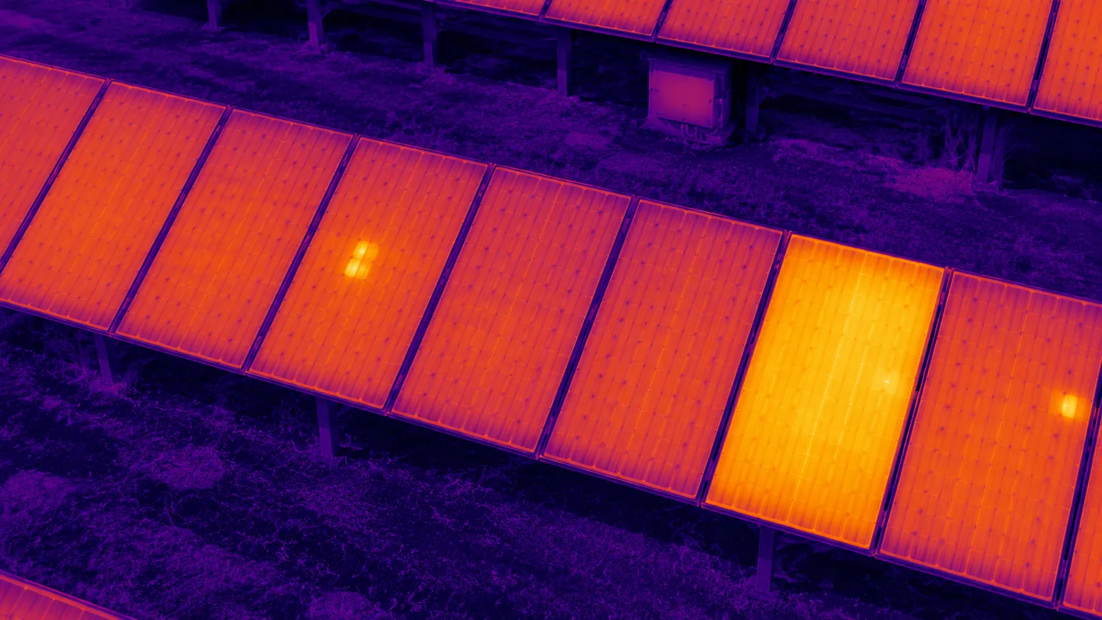 Fig. 07 · IR Thermography, PV Array
IR thermal inspection: detect component failure in photovoltaic and electrical systems, moisture leakage from water tanks, and building energy losses.
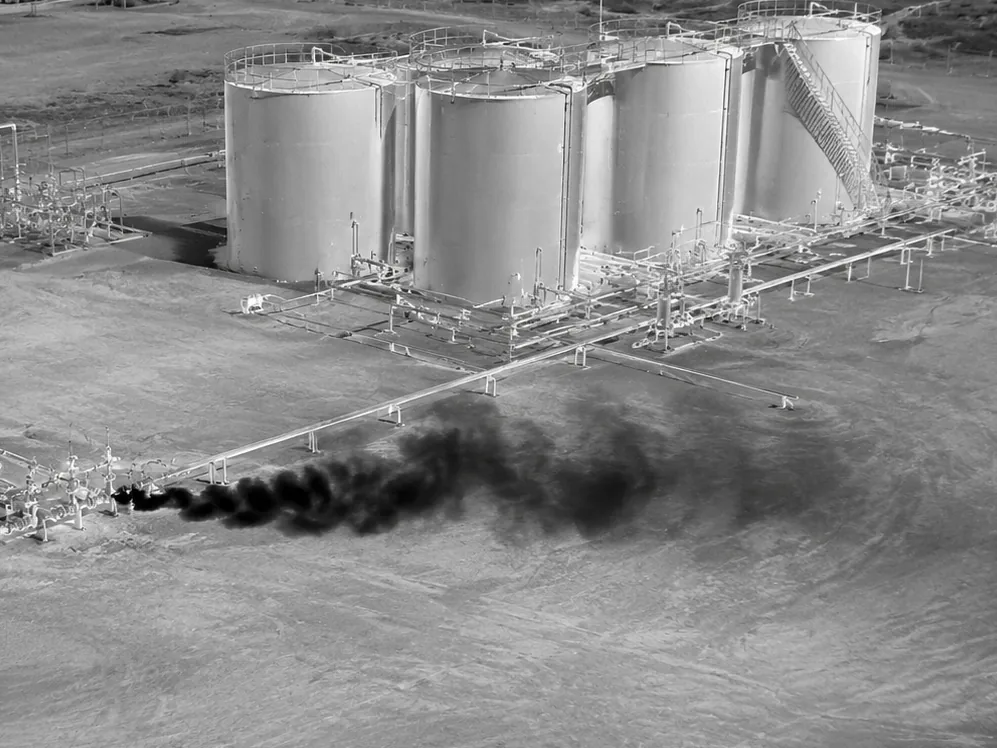 Fig. 08 · Optical Gas Imaging
Detect, locate, document, and image gas leaks. We offer custom media conversion, report generation, data review and geo-analysis, and delivery pipelines to make OGI data actionable.
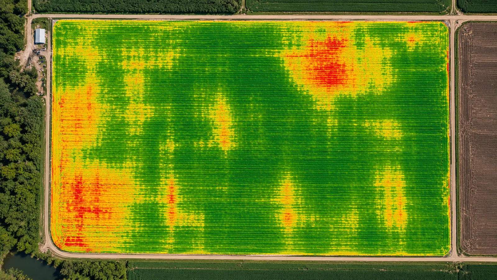 Fig. 09 · Multispectral, NDVI Composite
Crop-health products for large-scale agriculture — NDVI, NDRE, or custom indexes developed to meet your needs. We deliver maps, prescriptions, and custom insights.
Bespoke data workflows in Python, MATLAB, and Bash shell. ETL pipelines, custom schemas and data formats, push/pull API design and server/client development, and the metadata to make any of it auditable and useful into the future.
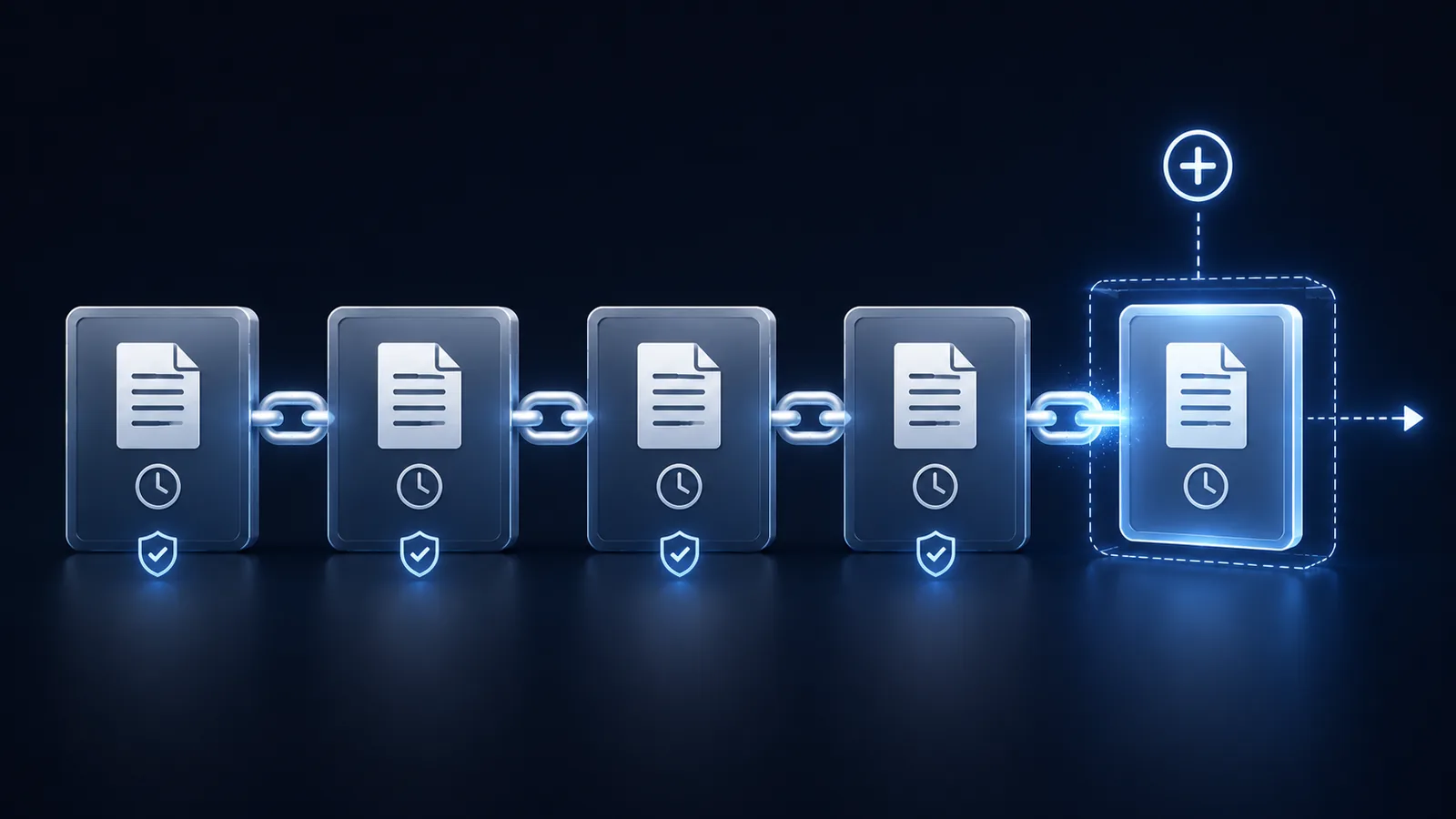 Fig. 11 · Immutable Blockchain Records
Provably unalterable records provide customer assurance, compliance, auditability, and liability management through concrete timestamps, chain of custody, cryptographic signatures, and permanent records. Integrate into existing applications or build for the future from the ground up.
We are equipped to assist with any stage of your process to get you the data and insights you need.
Requirements capture and scoping, mission planning, sensor selection and integration, collection training. Real-world experience in how to work with the constraints of the reality of remote-sensing collections.
Sensor operation, end-to-end flight and capture by licensed and experienced UAS pilots, logs preserved, redundant data storage.
Calibration, processing, QA — done using a mix of industry-standard tools, and custom-developed tools, validated by hand where it matters.
Hand-off in the format and the system your team already uses — EAM push, API pull, hosted or white-label portal, or easy, secure web downloads.
Engagements available globally. Work scoped to fit the team that already does the day-to-day.
The Pendleton UAS test range — and the corridor opening toward Tillamook — sits inside an unusually varied testbed: high desert, river canyon, coastal range, and four real seasons within an afternoon's drive. Quiet country with a deep bench of operators, fabricators, and trades to draw on.
We work globally from here. If your job needs onsite work, we travel; if it needs a partner who can take raw captures and give back deliverables your team can actually use, that is the work we do.
A short note describing the work, the timeline, and the format you need out the other end is plenty to start a conversation.